|
| |
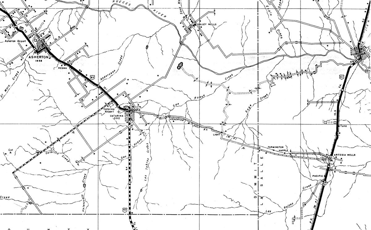
Asherton & Gulf Railway Company (Tex.), map showing route in 1936. |
|
| |
|
|
| Source: |
Texas. 1936. General Highway Map, Dimmit and LaSalle County, Texas. Austin, Tex.: Texas State Highway Department, 1936. |
| Counties: |
Dimmit, LaSalle. |
| Communities: |
Asherton, Regna, Light, Farmington, Happle, Artesia Wells. |
| Remarks: |
Map images were scanned from xeroxed reproductions provided by the Texas State Library and Archives, Austin, Texas. |
|
|
| |
|
|
| |
<< Map Index |
|
| |
|
|
| |
|
|
|
|
|
|
 |
| Information and images were digitized and proofread from the original source documents by Murry Hammond. Contact Murry for all corrections, additions, and contributions of new material. |
|
| |
|
|