|
| |
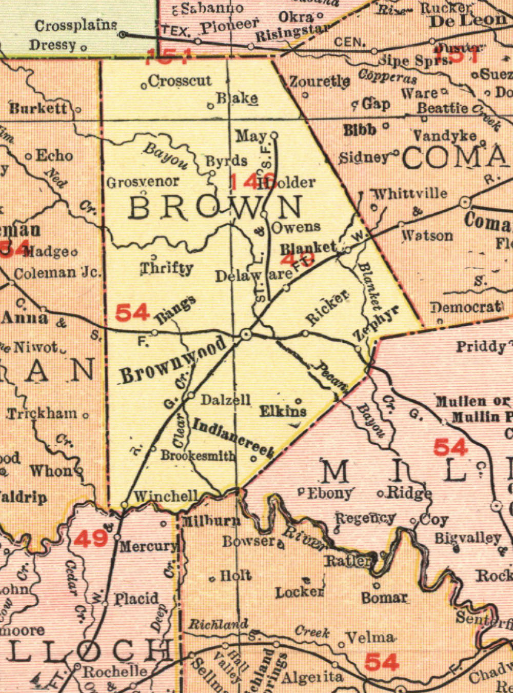
Brownwood North & South Texas Railway Company, map showing route in 1912. |
|
| |
|
|
| Source: |
Rand-McNally and Company. Rand-McNally's Commercial Atlas of America. Chicago: Rand-McNally, 1912. |
| Counties: |
Brown. |
| Communities: |
Brownwood, Owens, May. |
| Remarks: |
In 1912 the BN&ST was under control of the St. Louis-San Francisco Railway Company of Texas, and so is noted as SLSF on the 1912 edition of the Rand-McNally map. |
|
|
| |
<< Map Index |
|
| |
|
|
| |
|
|
|
|
|
|
 |
| Information and images were digitized and proofread from the original source documents by Murry Hammond. Contact Murry for all corrections, additions, and contributions of new material. |
|
| |
|
|