|
| |
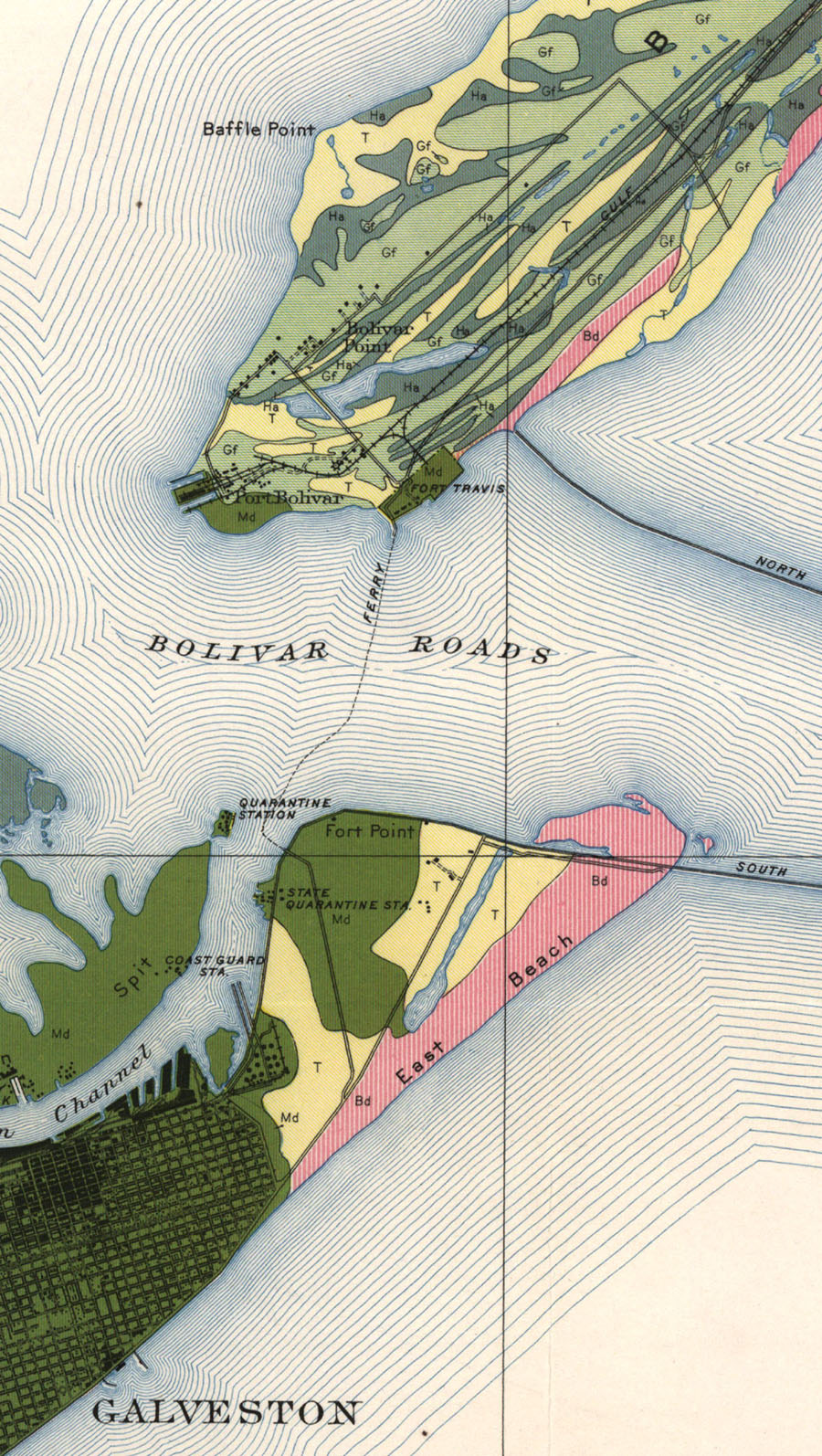
Galveston-Port Bolivar Ferry, map showing route between Port Bolivar and Galveston in 1935. |
|
| |
|
|
| Source: |
Foster, Z. C., and W. J. Moran. Soil Survey of Galveston County, Texas. Washington: U.S. Dept. of Agriculture, Bureau of Chemistry and Soils, 1935. |
| Counties: |
Galveston County. |
| Communities: |
Galveston, Port Bolivar. |
| Remarks: |
At Port Bolivar can be seen the industrial tracks of the Gulf & Interstate and the Santa Fe Dock & Channel Companies. |
|
|
| |
<< Map Index |
|
| |
|
|
| |
|
|
|
|
|
|
 |
| Information and images were digitized and proofread from the original source documents by Murry Hammond. Contact Murry for all corrections, additions, and contributions of new material. |
|
| |
|
|