|
| |
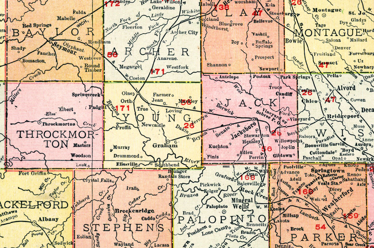
Gulf, Texas & Western Railway Company (Tex.), map showing route in 1913. |
|
| |
|
|
| Source: |
Rand-McNally and Company. Rand-McNally's Commercial Atlas of America. Chicago: Rand-McNally, 1913. |
| Counties: |
Jack, Young, Archer, Baylor, Palo Pinto. |
| Communities: |
Mineral Wells, Salesville, Perrin, Hensley, Jacksboro, Berwick, Jermyn, Loving, Megargel, Jean, Olney, Coston, Westover, Rendham, Olyphant, Seymour. |
|
|
| |
<< Map Index |
|
| |
|
|
| |
|
|
|
|
|
|
 |
| Information and images were digitized and proofread from the original source documents by Murry Hammond. Contact Murry for all corrections, additions, and contributions of new material. |
|
| |
|
|