|
| |
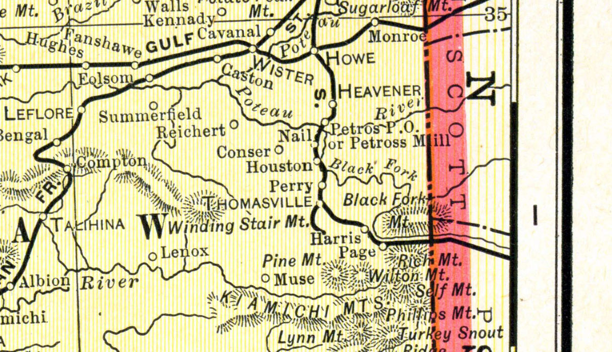
King-Ryder Lumber Company at Thomasville, Oklahoma. Map showing tram route in 1901. |
|
| |
|
|
| Source: |
Cram, George F. Map of Oklahoma and Indian Territories. Cram's Atlas of the World, Ancient and Modern: New Census Edition. Chicago, Ill: George F. Cram, 1901. |
| Counties: |
LeFlore County. |
| Communities: |
Thomasville (later Stapp), Zoe, Red Lick. |
| Remarks: |
This was Long-Bell's Thomasville plant, operated under the subsidiary King-Ryder Lumber Company. Long-Bell ceased milling at Thomasville about the time of the creation of this map and relocated their King-Ryder operation to Bonami, Louisiana. The Long-Bell railroad at Thomasville was also known as the "Kingston & Choctaw Valley Railroad." |
|
|
| |
<< Map Index |
|
| |
|
|
| |
|
|
|
|
|
|
 |
| Information and images were digitized and proofread from the original source documents by Murry Hammond. Contact Murry for all corrections, additions, and contributions of new material. |
|
| |
|
|